-
Unseasonably warm weather is causing ice jams in some rivers across the state this week.
-
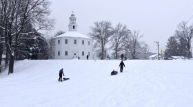
Many towns across the state saw 9 to 14 inches Monday, with more snow on the way.
-
Some towns in Vermont are dealing with a shortage of road salt ahead of a very cold, snowy weekend.
-
Public safety officials are urging people to avoid driving on Monday as an ice storm brings potentially dangerous conditions to Vermont.
-
These resources will help you avoid traffic, map power outages, track snow plows and stay healthy through the winter.
-
The UVM Water Resources Institute has applied to the town of Lyndon for a zoning permit for its first weather station.
-
Spring-fed and shallow dug wells at Vermont’s old homes are particularly vulnerable in the drought. Drilling a new well can cost as much as $20,000.
-
The flooding came on the exact anniversary of catastrophic flooding that hit Vermont on July 10, 2023 and again, on the same day, in 2024.
-
Areas of the Champlain Valley remain under an Extreme Heat Warning until 8 p.m. on Tuesday. This heat event is part of a longer-term trend in Vermont connected to human-caused climate change.
-
“I think collectively, we’re all in agreement that Mother Nature can stop," said one creemee shop owner.
Vermont Public is independent, community-supported media, serving Vermont with trusted, relevant and essential information. We share stories that bring people together, from every corner of our region.
© 2026 Vermont Public | 365 Troy Ave. Colchester, VT 05446
Public Files:
WVTI · WOXM · WVBA · WVNK · WVTQ
WVPR · WRVT · WOXR · WNCH · WVPA
WVPS · WVXR · WETK · WVTB · WVER
WVER-FM · WVLR-FM · WBTN-FM
For assistance accessing our public files, please contact hello@vermontpublic.org or call 802-655-9451.
Play Live Radio
Next Up:
0:00
0:00
Available On Air Stations


