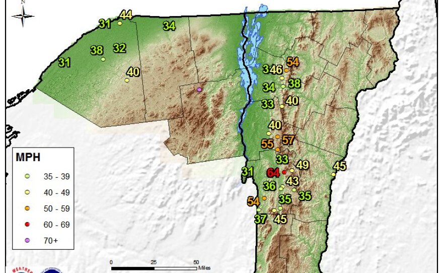
Harsh winds after a weekend of slushy spring snow have left many through the state at risk of losing power Monday.
Here's the latest on conditions across our region:
Latest Forecast
A high wind warning is in effect for the western slopes of the Green Mountains, Rutland and Bennington counties through 11 p.m.
According to the Eye On The Sky guys:
[Monday a.m.] Scattered sleet, freezing rain, and rain showers, changing to steady rain south, scattered north late morning through afternoon. Windy, strongest over the higher terrain. Highs in the mid 30s to low 40s east, in the 40s west. Southeast winds 15 to 35 mph, with gusts to 45 mph, but up to 75 mph along the western slopes of the Green Mountains.
Here's the updated max wind gust map. The strongest winds aloft still haven't arrived so be careful today! Scattered power outages are expected across the western slopes. #vtwx #nywx pic.twitter.com/zB1ua1edRy
— NWS Burlington (@NWSBurlington) April 16, 2018
Click here for the latest school closure updates.
RELATED: "How Do Schools Decide When To Close In Bad Weather?" [VPR, Feb. 2015]
Driving Conditions
RELATED: "Winter Driving: Tires, Tactics And Road Salt" [VPR, Nov. 2017]
Outages
For the latest on outages across the state, consult the Vermont Outages Map.
RELATED: "Tips From Vermonters: How To Stay Safe And Warm In Sub-Zero Weather" [VPR, Dec. 2017]


