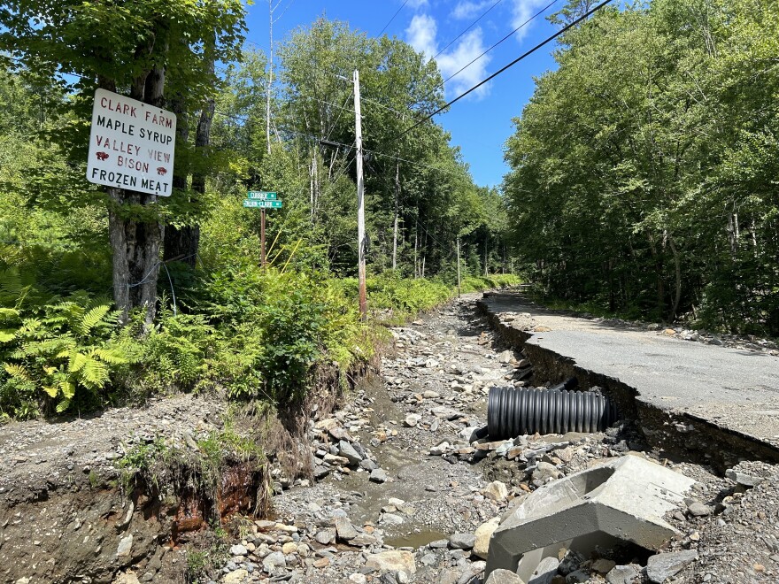
It’s official. This summer was the wettest on record for New Hampshire.
The state got more than 21 inches of rain in June, July and August – about 8 inches more than the average, and the most since recordkeeping started in 1895, according to the National Oceanic and Atmospheric Administration.
All that water pummeled roads, farms and buildings, leaving communities across the state with millions of dollars of damage.
It wasn’t just us. Every New England state had one of their top 10 wettest summers this year.
Vermont also had its wettest summer on record, while Maine’s summer was their second-wettest, just behind 1917. Massachusetts had its second-wettest summer on record, tied with the summer of 1955, and slightly drier than the summer of 1938. Connecticut’s was their 9th wettest, and Rhode Island’s was their 10th.
Various weather patterns contributed to the intensity of the rain in New England this summer. But the record-breaking precipitation also fits with what climate experts are expecting, as humans continue to burn fossil fuels and the atmosphere gets warmer.
Read more: Why this summer in New England was really wet.
New Hampshire is getting hotter and wetter; annual precipitation has increased 12% in the past 120 years. Extreme precipitation – as exhibited by the record number of flash flood warnings in the Granite State this July – is expected to get worse, too. Recent research from Dartmouth shows heavy rain and snow events are also expected to intensify.
Samantha Borisoff, a climatologist with the National Oceanic and Atmospheric Administration's Northeast regional climate center at Cornell, says the state’s summer record is in line with how scientists expect climate change to affect New England.
“We are seeing overall precipitation increasing,” she said. “We're also seeing an increase in these extreme precipitation events.”
As the atmosphere gets hotter, she said, it can hold more water, because warmer air can hold more moisture.
“If the atmosphere has the ability to contain more moisture, it can evaporate more from oceans and ponds and waterways and the soil,” she said. “So as that happens and your temperatures get warmer, that evaporation continues and continues and continues.”
That’s also why New England could see more short-term droughts, Borisoff said. But once the moisture has evaporated, it gets stuck in the atmosphere.
“We have all of this moisture that's just sitting there waiting for something to kind of spark it to be wrung out,” she said.
In New England, that spark could be a nor'easter, a tropical system, or a cold front that causes the water to fall down as extreme rain.
Borisoff said 6 of the 10 wettest summers on record in New Hampshire have happened since 2000.
Mary Stampone, New Hampshire’s state climatologist and a professor at the University of New Hampshire, said the record rainfall paints a picture of climate change in the state.
“We’re getting wetter because of these extreme events,” she said. “We’re getting wetter because of these intense events. And we saw that this summer. Every week there for a while, we were getting multi-inch precipitation events.”
Stampone said it’s important to think about adapting to the wetter climate in the state.
“We have to be prepared to deal with the changes in climate and how it’s manifesting in more extreme weather patterns,” she said. “If we’re already reaching capacity in terms of how much extreme weather our social systems or socioeconomic systems can handle, we can think about, well, it’s going to continue to get worse if we don’t mitigate climate change.”
And, she said, it’s important to remember there’s still time to address climate change.
“This can be the worst we get,” she said. “Or this can be the best we’re going to have in the future.”
Federal assistance is on its way to help with repairs in Belknap, Carroll, Cheshire, Coos, and Sullivan counties from flooding in July. And the U.S. Department of Agriculture has made it easier for farmers to apply for assistance with crop losses and soil damage. But the path ahead could still be long, particularly for communities still rebuilding from floods in 2021.


